Hike Report for Mount Blue
Mount Blue is located in Maine, United States. It has an elevation of 973 meters above sea level. It is located at the following coordinates: (44.7281, -70.342).
This hike report was written by Douglas Twitchell, about a hike on Tuesday, July 8, 2008.
Not enough votes to display a rating
Directions to Trailhead
Begin by finding the intersection of Rte 142 and 156 in Weld. From this intersection, you will turn onto Center Hill Road. Center Hill Road takes you most of the way around Mount Blue State Park. When Center Hill Road makes a left hand 90 degree turn, and you see the Mount Blue Road straight ahead, you want to go on the Mount Blue Road, instead of turning onto Center Hill Road.
Unfortunately, when we hiked, Mount Blue Road was closed because of wash outs, so we had to hike all the way in to the trail head from that intersection. The Mount Blue Road dead-ends in a parking lot right at the trail head.
Unfortunately, when we hiked, Mount Blue Road was closed because of wash outs, so we had to hike all the way in to the trail head from that intersection. The Mount Blue Road dead-ends in a parking lot right at the trail head.
Hike Report
I hiked Mount Blue with my brother and his three oldest sons. We were disappointed right off the bat to discover that the Mount Blue Road was closed, and we would have to hike in from there. A fellow who lived at a house nearby told us we could hike in to the trail head in less than a half hour, if we walked briskly.
We took closer to an hour.
As you hike in on that road, you'll come to a fork in the road, and you'll want to bear right, instead of left, staying on the main road. Once you reach the end of this road, it's obvious where the trail head is - there's a big sign marking it.
Once you get to the trail head, you have about 1.6 more miles to hike, and about 1800 feet of elevation to gain.
Most of that is in the woods, so don't expect to see many nice views along the way. As you get near the top, there is a place where, hiking up over a steep section of boulders, you can look behind you and see a nice view. Other than that, all your views are at the top.
Don't worry about forks in the trail - there are none. Just follow the very clear path, and you won't have any worries about losing your way.
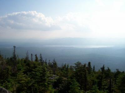
Very close to the summit you will be able to take a very short detour off to the right; this takes you to a ledge, and from that ledge you can look out over Webb Lake, for a nice view.
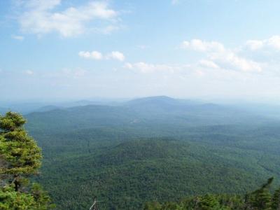
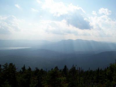
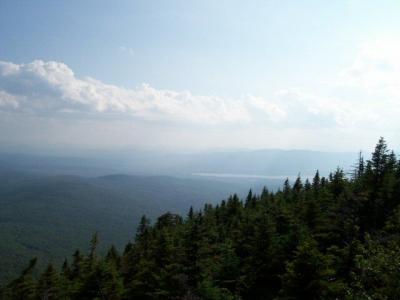
The summit is fairly unimpressive, at first glance; you just come out into a clearing surrounded by trees, with a small shack, and a broken down fire tower. Don't worry - you haven't hiked for nothing. To both the left and right you'll see signs for "scenic vistas". To your right you'll see some of the mountains south of Webb Lake, to the left (after hiking through the woods for a minute or two) you'll see Tumbledown Mountain, Little Jackson, Big Jackson, and Blueberry Mountain. Very nice views.
We had supper on the peak (peanut butter and jelly sandwiches), and then headed back down, making much better time on the return trip.
We started hiking at about 2:10 in the afternoon, and returned to the cars right around 8:00 in the evening. Fortunately, because it is summer, we had plenty of sunlight!
Difficulty
If you look at Mount Blue from across Webb Lake, you will realize that it is very cone shaped. This means that you're mostly hiking uphill, without many nice easy sections. We did this hike with two adults, two teenagers, and one pre-teen. Most were pretty tired by the end of the hike, but we all made it!
Statistics
This hike took us a total of six hours, though we would have been much quicker if we hadn't had to hike the Mount Blue Road (that took an hour each way). Our total distance hiked was around eight miles, and we gained about 1800 feet of elevation.
If your hiking party is in good physical condition, you'll be able to do the entire hike in well under six hours. AND, if the Mount Blue Road is open when you go, you'll be able to do it in under four hours.
If your hiking party is in good physical condition, you'll be able to do the entire hike in well under six hours. AND, if the Mount Blue Road is open when you go, you'll be able to do it in under four hours.
Images


Images on this page are the property of Douglas Twitchell, and may not be used without permission of the owner.


