Hike Report for Table Rock
Table Rock is located in Maine, United States. It has an elevation of 734 meters above sea level. It is located at the following coordinates: (44.5882, -70.9358).
This hike report was written by Douglas Twitchell, about a hike on Thursday, September 11, 2008.
This report describes a hike on Appalachian Trail
This report describes a hike on Appalachian Trail
Not enough votes to display a rating
Directions to Appalachian Trail
Drive up Route 26 through Bethel and Newry. Eventually you enter the Grafton Notch area, with Old Speck (Maine's third tallest peak) on your left.
You will see, also on the left, a parking area for hikers. This is clearly marked. Pull in here and park. Now walk toward the road, and on the left side of the parking lot you'll see a display with information about the Appalachian Trail, and mountains in the area. Just beyond this is the trail toward Tablerock. It cuts through the woods for a very brief moment, then crosses Route 26, and continues on toward Tablerock and the Baldpates.
You will see, also on the left, a parking area for hikers. This is clearly marked. Pull in here and park. Now walk toward the road, and on the left side of the parking lot you'll see a display with information about the Appalachian Trail, and mountains in the area. Just beyond this is the trail toward Tablerock. It cuts through the woods for a very brief moment, then crosses Route 26, and continues on toward Tablerock and the Baldpates.
Hike Report
Table Rock isn't actually a mountain - it's a plateau that's sort of on the way to the summit of Baldpate.
Bobby, Tom, and I did this in the morning on a fairly nice, somewhat clear day. Much better weather than the last time I hiked it, which was in mid-October last fall.
We were surprised to find that there is a $2.00 fee for using the trail through Grafton Notch. In the parking lot by the mountain there is a metal tube you can drop you fee in, though there is no one there checking to make sure you do it. Not all of us had $2.00 with us, because we didn't know the fee was there (I think it's only in effect for part of the year). Please remember to bring your fee - those fees, even though they are on the "honor system" are important to keeping the trails maintained!
After you've crossed Route 26 on the AT, a few minutes later you'll come to a fork in the trail. This is where you decide how adventurous you are. The Appalachian Trail goes left. Take this if you aren't feeling adventurous. The other trail is the "Table Rock Trail", and it is MUCH steeper.
We took the AT, because were planning to do another steep hike that same day, and we didn't want to get ourselves too tired out on Table Rock.
You hike up the AT for maybe 15 or 20 minutes, and then you'll see another fork. Here, if you go straight, you continue on the AT toward the Baldpates. Turning right sends you over toward Table Rock. It's only another 1/2 mile to the plateau.
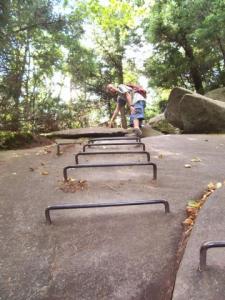
At one point, because you have to climb over a very steep boulder, you'll find rungs built into the rock. This makes the climb very easy.
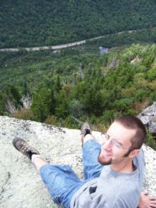
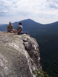
When you get to that boulder, you're almost there. Just a little bit further and you come out onto a flat plateau (the Table Rock) which is about 900 feet above Route 26, and gives you a nice view of Grafton Notch area and, on a clear day, Old Speck.
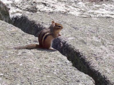
There were several chipmunks at the summit, and clearly people make a habit of feeding them, because they are quite brazen, walking right up to you and sniffing your shoes, and begging for food.
I snapped several nice pictures of the wildlife, Bobby and Tom, and the mountains around. We had a nice visit with a fellow from Tennessee who was vacationing in Maine, and then we headed back down.
A very enjoyable view for not a huge amount of effort.
Difficulty
We followed the Appalachian Trail to the Tablerock side-trail. This is the easier way to go - you can also take the Tablerock Trail from the bottom, which is much steeper.
The Appalachian Trail is not too difficult here, and this hike is done by families. (Just remember, keep a close eye on your kids when you get to the plateau - this is a precipice which is NOT fenced in!
The Appalachian Trail is not too difficult here, and this hike is done by families. (Just remember, keep a close eye on your kids when you get to the plateau - this is a precipice which is NOT fenced in!
Statistics
Elevation gain was 900 feet, and it took us probably half an hour (maybe a little more) to get to the top.
Images


Images on this page are the property of Douglas Twitchell, and may not be used without permission of the owner.


