Hike Report for Kearsarge North
Kearsarge North is located in New Hampshire, United States. It has an elevation of 991 meters above sea level. It is located at the following coordinates: (44.1056, -71.0942).
This hike report was written by Douglas Twitchell, about a hike on Monday, May 6, 2013.
This report describes a hike on Kearsarge North Trail
This report describes a hike on Kearsarge North Trail
Directions to Kearsarge North Trail
Finding the trail is easy; head up route 302 through North Conway into Intervale.
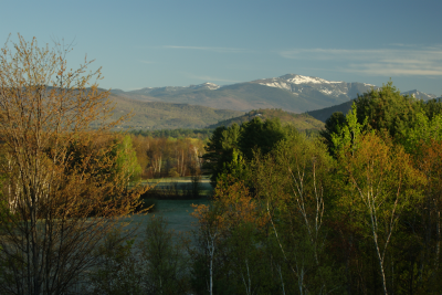
Intervale Scenic Turnout
The Intervale scenic turnout (which is tough to miss!) is on the left, and immediately following that the Hurricane Mountain road is on the right. Take the Hurricane Mountain Road for just a couple miles. You'll cross Mt. Surprise Road and Kearsarge Road, then a little further down the road there is a small parking area on the left side of the road. This is where you park. The start of the trail is marked with a sign.
Hike Report
I arrived at the trailhead at about 6:30 AM, and it was very chilly for the first half-hour or so.
The trail is marked with yellow blazes, but at times the blazes were not obvious, so it's important to pay attention to what you are doing. I think I actually wandered off the trail at one point, but quickly reconnected a minute or two later.
Most of the trail is in the woods, with sections of shallow incline and steeper incline. You won't see much for scenic views until you're well over halfway up the mountain.
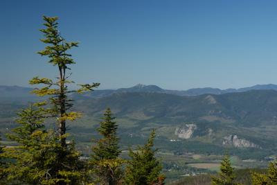
View of Mount Chocorua from the trail
The first nice view you get is of Mount Chocorua's rugged, jagged peak. Since Chocorua is one of my favorite mountains, I always enjoy seeing this!
When you get to the point where you can see mountains behind you, you've probably got 1/2 to 3/4 hour hiking left.
A little bit beyond the open ledge with views, I started finding snow and mud and water on the trail - it's early May, after all! Then I found large stretches of trail where the snow was crusted and icy, making the hike a bit more challenging, since I didn't have spikes! In a couple places I had to bushwhack through the woods to avoid icy boulders.
If you're paying attention, as you hike through the woods after this point, you can see Mount Washington to your left. If you miss it, though, don't worry, because you'll get a clear view of Washington from the summit!
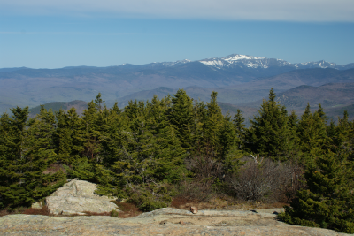
Mount Washington from the summit
One of the great things about this peak is that it has one of the few remaining fire towers that is actually open to the public. From here you can get spectacular views in 360 degrees.
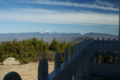
View from the tower
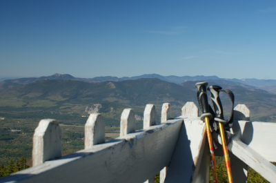
View from the tower
On this particular day, everything to the east was still fogged in, so I had an interesting view of Pleasant Mountain (Bridgton, ME) peeking out from the fog
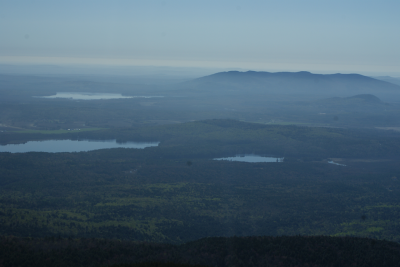
Pleasant Mountain in the fog
After taking a short break, I headed back down. Going over the ice was harder on the way down than on the way up, and I was glad I had my hiking poles with me!
The trail is marked with yellow blazes, but at times the blazes were not obvious, so it's important to pay attention to what you are doing. I think I actually wandered off the trail at one point, but quickly reconnected a minute or two later.
Most of the trail is in the woods, with sections of shallow incline and steeper incline. You won't see much for scenic views until you're well over halfway up the mountain.

View of Mount Chocorua from the trail
The first nice view you get is of Mount Chocorua's rugged, jagged peak. Since Chocorua is one of my favorite mountains, I always enjoy seeing this!
When you get to the point where you can see mountains behind you, you've probably got 1/2 to 3/4 hour hiking left.
A little bit beyond the open ledge with views, I started finding snow and mud and water on the trail - it's early May, after all! Then I found large stretches of trail where the snow was crusted and icy, making the hike a bit more challenging, since I didn't have spikes! In a couple places I had to bushwhack through the woods to avoid icy boulders.
If you're paying attention, as you hike through the woods after this point, you can see Mount Washington to your left. If you miss it, though, don't worry, because you'll get a clear view of Washington from the summit!

Mount Washington from the summit
One of the great things about this peak is that it has one of the few remaining fire towers that is actually open to the public. From here you can get spectacular views in 360 degrees.

View from the tower

View from the tower
On this particular day, everything to the east was still fogged in, so I had an interesting view of Pleasant Mountain (Bridgton, ME) peeking out from the fog

Pleasant Mountain in the fog
After taking a short break, I headed back down. Going over the ice was harder on the way down than on the way up, and I was glad I had my hiking poles with me!
Difficulty
In general, Kearsarge North is not a difficult climb, though it's long for young kids. I would say this is good for teens and adults. But beware if you hike it too early in the spring; during the first week of May there was plenty of snow and ice on the trail!
Statistics
This hike was approximately 6 miles round trip. I usually take about 2.5 hours getting up, and another 2 hours coming back down.
Images


Images on this page are the property of Douglas Twitchell, and may not be used without permission of the owner.


