Hike Report for Jockey Cap
Jockey Cap is located in Maine, United States. It has an elevation of 186 meters above sea level. It is located at the following coordinates: (44.0222, -70.9624).
This hike report was written by Douglas Twitchell, about a hike on Saturday, September 15, 2012.
Directions to Trailhead
Finding Jockey Cap is super easy. Traveling down 302 from Bridgton to Fryeburg, it's on the right, next to the Jockey Cap Motel.
Park in the parking lot, and it's almost impossible to miss the trail!
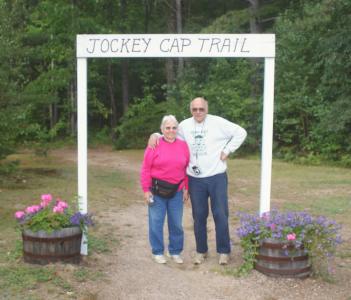
The most obvious and well-marked trailhead ever!
NOTE: the Jockey Cap Motel is gone now, replaced by a "General Dollar" store. You can continue down the road past the convenience store if you want to go through the cute "archway", but there's not much parking there. Read my updated hike report for more information.
Park in the parking lot, and it's almost impossible to miss the trail!

The most obvious and well-marked trailhead ever!
NOTE: the Jockey Cap Motel is gone now, replaced by a "General Dollar" store. You can continue down the road past the convenience store if you want to go through the cute "archway", but there's not much parking there. Read my updated hike report for more information.
Hike Report
My parents wanted to do a hike with me, but didn't want to do anything extraordinarily difficult (they keep reminding me that they're getting older!).
So we went down to Fryeburg to hike Jockey Cap. The trail is very short (I don't remember for sure, but I think it only took us about 15 minutes to get to the summit.)
Most of the trail is gradual and in the woods. There are a lot of chipmunks and other wildlife around, and don't seem terribly frightened of people.
The last little bit of the hike is steeper, and takes you up over the rocky dome to the summit.
One of the really nice things about this hike is that there is a pedestal at the top with a 360 degree 'map' of all the mountains you can see. Stand on one side of it and look across, and you see the named profiles of the mountains in front of you. It's a great way to get familiar with the mountains in the area.
Difficulty
Short and easy, and accessible for most ages. For a bigger challenge, some people do harnessed rock climbing over the steep face:
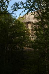
Not the 'normal' trail

Not the 'normal' trail
Images
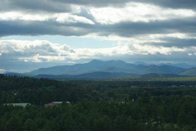
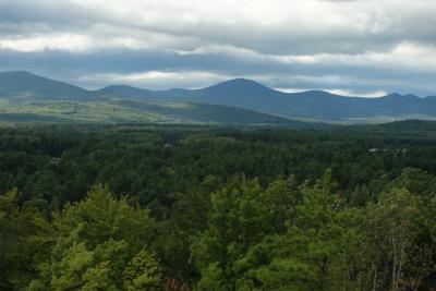


Images on this page are the property of Douglas Twitchell, and may not be used without permission of the owner.


