Hike Report for Aziscohos Mountain
Aziscohos Mountain is located in Maine, United States. It has an elevation of 974 meters above sea level. It is located at the following coordinates: (44.9141, -71.0018).
This hike report was written by Douglas Twitchell, about a hike on Tuesday, August 26, 2008.
Not enough votes to display a rating
Directions to Trailhead
The best way to find the trailhead is to first find the dam along Route 16 east of Wilsons Mills. This is an easy landmark to find; Route 16 passes over a bridge right at the dam.
Once you've found the bridge, head south on Route 16 for about one mile. On the right you'll see a gravel road heading up a slope. We parked by the side of this road, and continued on by foot just a few yards down Route 16, until we found the trail, which was marked by a broken road sign which read "Mt Trail". (I suspect it was supposed to say "Aziscohos Mt Trail", but as I said, the sign was broken)
Once you've found the bridge, head south on Route 16 for about one mile. On the right you'll see a gravel road heading up a slope. We parked by the side of this road, and continued on by foot just a few yards down Route 16, until we found the trail, which was marked by a broken road sign which read "Mt Trail". (I suspect it was supposed to say "Aziscohos Mt Trail", but as I said, the sign was broken)
Hike Report
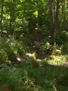
Initially, we were going to have four of us going on this hike, but two had to cancel, so it was just me and Alex. Because of all the rain we've had this summer, the first part of the trail was quite muddy (though we met someone along the way who said it was MUCH muddier last summer). Apparently muddy is common for this trail.
Once you get beyond the muddy part, the trail gets a bit steeper, and there are a few places you have to climb up over some boulders, but I've definitely done much harder hikes this summer.
There are no forks in the trail until you get almost to the summit. Just before the summit the trail hits a fork where you can go either left or right. Right is the "North Trail", which takes you back down somewhere else on Route 16 (though I don't know where that other trail head is). Left takes you directly to the summit.
I think, when we broke out of the trees and onto the summit, our exact words were "Wow!" and "Holy smokes!"
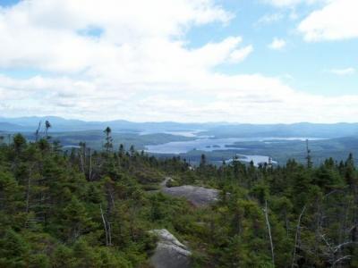
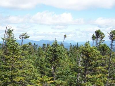
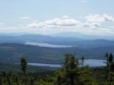
Beautiful views in all directions. Mount Washington stands high above all the surrounding mountains, making it very easy to spot. Bigelow mountain range, with West Peak and Avery Peak, is also visible.
And then there are the lakes. Rangeley, Mooselookmeguntic, and many other smaller lakes. Just beautiful.
While we were on the summit we bumped into a couple hikers from New Jersey who say that Aziscohos is their favorite mountain, and they hike it every summer when they're in Maine. We had a nice long chat with them, had lunch, ate some wild blueberries, and then headed back down.
At some point I want to do both West Kennebego and Bald Mountain, but those will have to wait for another day.
Difficulty
Not at all a difficult hike, and much shorter than I expected. The first third was a very gradual incline, and then got a bit steeper for the last two thirds, but not terribly steep. We saw both children and teens on this hike, so this appears to be a family destination.
Statistics
We took about 1.5 hours hiking up, and another hour on the way back down. Our elevation gain was about 1000 feet, and the hike length was 1.75 miles one way.
Images


Images on this page are the property of Douglas Twitchell, and may not be used without permission of the owner.


