Hike Report for Bradbury Mountain
Bradbury Mountain is located in Maine, United States. It has an elevation of 143 meters above sea level. It is located at the following coordinates: (43.9026, -70.1823).
This hike report was written by Douglas Twitchell, about a hike on Sunday, October 5, 2008.
Directions to Trailhead
If you're driving south/west on Route 9 through Pownal, Maine, Bradbury Mountain Park is on your right. The trailheads are well marked and obvious, near the park's parking lots.
Hike Report
Bradbury Mountain has never been on my radar to hike. My Maine Atlas and Gazetteer shows it as a 200 foot elevation gain to the summit. Doesn't seem like much of a mountain to me.
But my brother's church is taking a group of kids there next week, and they wanted to explore the place first, so I tagged along; it was a good excuse to visit with Jonathan for a bit.
When you enter the park, if you park in the upper lot, the Summit Trail (the shortest and steepest trail) is right next to you, by the playground. We hiked this trail to the summit. Only took us a few minutes.

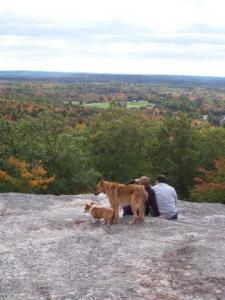
Dogs on the summit
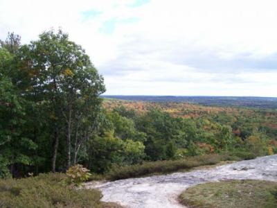
I was surprised to find out how utterly flat the horizon line was; not a single mountain in view. Not my idea of a stunning vista, but I suppose that's to be expected when you only hike for a few minutes.

Flat horizon at the summit
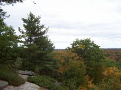
We then went across the bluff trail to another scenic lookout point. and then back down. Near the bottom is a quarry, which you can get to with just a short detour.

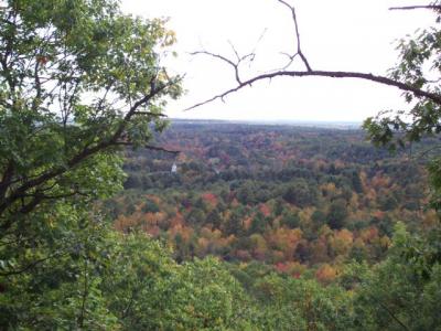
Once we got back to the parking lot, we agreed that we had time to go back up by a second trail - the South Ridge trail, because there is one more scenic outlook point. So off we went (this trail is off the lower parking lot) and visited the south ridge, then continued on to the summit a second time, and then back down the Summit Trail again.
There are three scenic outlook points, and if you want to hit all of them, you'll need to make sure you take the South Ridge Trail and the Bluff Trail.
To be honest, none of these scenic lookout points impressed me very much - the last time I saw a horizon line that flat, I was out in the Mid West. But it's an easy hike, and I'm sure it's convenient for both Auburn and Portland families, which is probably why it's so popular.

Hiking up and down the mountain twice, and stopping to chat and take pictures took us probably an hour and a half.
But my brother's church is taking a group of kids there next week, and they wanted to explore the place first, so I tagged along; it was a good excuse to visit with Jonathan for a bit.
When you enter the park, if you park in the upper lot, the Summit Trail (the shortest and steepest trail) is right next to you, by the playground. We hiked this trail to the summit. Only took us a few minutes.

Dogs on the summit
I was surprised to find out how utterly flat the horizon line was; not a single mountain in view. Not my idea of a stunning vista, but I suppose that's to be expected when you only hike for a few minutes.

Flat horizon at the summit
We then went across the bluff trail to another scenic lookout point. and then back down. Near the bottom is a quarry, which you can get to with just a short detour.

Once we got back to the parking lot, we agreed that we had time to go back up by a second trail - the South Ridge trail, because there is one more scenic outlook point. So off we went (this trail is off the lower parking lot) and visited the south ridge, then continued on to the summit a second time, and then back down the Summit Trail again.
There are three scenic outlook points, and if you want to hit all of them, you'll need to make sure you take the South Ridge Trail and the Bluff Trail.
To be honest, none of these scenic lookout points impressed me very much - the last time I saw a horizon line that flat, I was out in the Mid West. But it's an easy hike, and I'm sure it's convenient for both Auburn and Portland families, which is probably why it's so popular.

Hiking up and down the mountain twice, and stopping to chat and take pictures took us probably an hour and a half.
Difficulty
This is a popular family destination. Easy and enjoyable for the whole family.
Statistics
Total elevation gain to the summit of Bradbury is 200 feet. If you take the shortest (steepest) route, it's only 2 or 3 tenths of a mile. The longest trail loops all the way around the park and is about a mile and a half long. There are many different trails you can take, and the park attendants give out maps of the park, so you can find out the length, location and difficulty of each trail.
Images


Images on this page are the property of Douglas Twitchell, and may not be used without permission of the owner.


