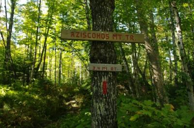
Hike Report for Aziscohos Mountain
Aziscohos Mountain is located in Maine, United States. It has an elevation of 974 meters above sea level. It is located at the following coordinates: (44.9141, -71.0018).
This hike report was written by tlfouhar, about a hike on Wednesday, September 21, 2011.
Not enough votes to display a rating
Directions to Trailhead
The best way to find the trailhead is to get to the Aziscohos Dam first on Rt 16 (We came from Oquossoc). Both trailheads are on the left, but we missed them and had to turn around at the Dam. Heading south, the South Trail is just a few yards beyond the bridge on the right side. If you look carefully just into the woods you will see a gate. There is a small parking area. The other trailhead is up the road about a mile on the right. We had to get out of the car and look for it because it has a small sign marking the start of the trail.
Hike Report
We found this a really enjoyable hike, but it is to bad that the trail isn't maintained and in better shape. The vegatation was so green with moss covering everthing it seemed! This is certainly the year for mushrooms and there were a lot around this trail. The views are really nice from the top with so many lakes and mountains around. We were disappointed that is was a hazy day and we could barely make out Mt. Washington.
Difficulty
This was not a hard hike with a pretty gradual ascent, but it was made harder because the trail was so wet. We took the South Trail down and found it overgrown with a lot of trees across the trail. The AMC guide says there are discreet blue blazes, but we didn't find any. The trail from the North is very well marked with red blazes. The South Trail was marked by red tape hanging in the the trees. At a few places the South Trail was completely overgrown.
Statistics
We were probably a total of 3 hours hiking it because the trail was very wet, muddy and slippery.
Images


Images on this page are the property of tlfouhar, and may not be used without permission of the owner.


