Hike Report for Mount Megunticook
Mount Megunticook is located in Maine, United States. It has an elevation of 422 meters above sea level. It is located at the following coordinates: (44.2413, -69.0677).
This hike report was written by Laura, about a hike on Saturday, September 17, 2005.
Directions to Trailhead
Mount Megunticook is a part of Camden Hills State Park, which is located 2 miles North of Camden on Route 1. Once you arrive at the park, just follow the signs until you reach the parking lot, and the trail is pretty easy to find, over in the corner where there's a signboard.
Hike Report
My family and I hiked this trail on September 6th, 2005. By the end of it I learned that it's very important to pace yourself at the beginning of a hike, to avoid tiring out before reaching the top. The trail starts out with a gradual steepness, and there are really no places that are completely level. Towards the end there are a few portions that are very steep and mostly composed of rock, and those who don't pace themselves properly and/or aren't is a good shape as they thought they were will have to take several breaks ;-)
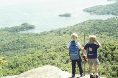
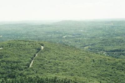
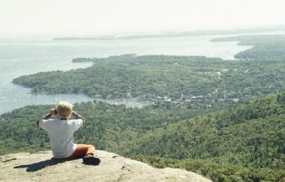
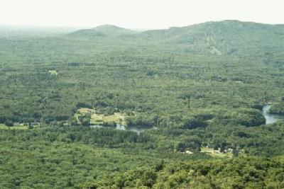
I don't recall many interesting sites along the way - there was a small stream at one point, of to the side of the trail. The view at the top is wonderful though. There's a great view of the ocean, which included many small boats tied up, at the time of year we were there. Most of the view is forestland - including Mount Battie, a smaller "mountain" nearby. There are a few buildings and roads visible as well.
The peak is a very bright and sunny place, at least it is during early afternoon on a sunny day in early September. I would recommend bringing a visor or sunglass if the sun is out on the day you hike - otherwise you'll be squinting at the view much of the time, like I was.
The hike back down is much shorter than the way up, largely because of the steepness. It's important to watch your step because of the rocks and tree roots, or try to walk slower - it's easy to go quickly down the steep portions of the trail, but it can also be hazardous if you happen to trip.
This is a good hike if you want a good view, and don't want to take all day to get there. Just don't start out too quickly, or else you might get too tired on the steep places.
Difficulty
This trail is pretty steep. Towards the end there are several portions that are very steep and take a while to get to the top of. It's also very rocky at times, (especially the steep areas) which makes the going slower.
My family brought children on this hike (but none under the age of 4), and they did pretty well (in fact, some of them got to the top before I did). I wouldn't recommend it for children much younger than four though, unless there is an adult present who is willing to carry them most of the way.
My family brought children on this hike (but none under the age of 4), and they did pretty well (in fact, some of them got to the top before I did). I wouldn't recommend it for children much younger than four though, unless there is an adult present who is willing to carry them most of the way.
Statistics
The elevation at Ocean Lookout is approximately 1300 feet. It took the members of my family about an hour to get to the top, give or take a few minutes. This trail is 1.3 miles to the peak, but we didn't go that far. Ocean Lookout is 0.8 of a mile, and it's another half mile to the peak.


